The Dingle Way is a 110 mile foot path circling Ireland’s
Dingle Peninsula. Jutting out into the Atlantic, its beauty is often compromised
by the climate and whims generated by the ocean’s moods, as we will soon find
out. Being somewhat short on time, we have chosen a three-day portion of the
path that otherwise takes 8 to 9 days to complete. The 40-mile portion we have
chosen is supposed to be the wildest and most remote segment.
Dingle to Dunquin
The path follows the road and is easy out of Dingle. After gently rising, it descends into the town
of Ventry. The road is lined with tall hedge rows. Most are full of black
raspberry plants that we happily gorge on. Our fingers are soon purple from
their sweet juices.
We stop in a small store to pick up a few things. We ask if
there are any other stores along our three-day route. The young lady didn't
know. In fact, she didn't know much about the Dingle Way itself, and the path
went right by her store! She had to ask her mom where the Way went and if there
were any stores we could stop at (two days away by foot, by the way).
She wasn't the first person we have talked to without any
knowledge of the trail. We were surprised at how many people were unaware of
its existence and many of these people were those that lived in the area.
After leaving the store, the trail turns and we find
ourselves on the beach. The sand is firm making for a softer walk than that out
on the tarmac. This is a nice alternative to the jarring of pavement walking
that wasn't doing MK's knees and joints any favors.
We are alone. There are no other walkers in sight.
This
again surprises me thinking the trail to be more popular than it apparently is.
I see only two other pairs of boot prints in the sand. We will end up seeing
some others in the coming days, but even so, there are nowhere near the number
of people I was expecting.
Off of the beach, the trail takes us back into the hedgerows.
It is muddy. The slop is made mostly of cow and sheep shit, a good amount of
piss, and the runoff from the adjacent fields. We are hemmed in by the tall,
impenetrable hedge rows, so there is no escape. The only alternative is to slog
on through the slop.
After a brief respite of road walking, we are now up onto the
slopes overlooking the cliffs that fall precipitously down into the Atlantic
Ocean. We are at the farthest western reaches of the trail, also the farthest
western reaches of the whole of Europe.
We parallel, and sometimes climb over, old, ancient stone
walls as we gain elevation. Circular stone enclosures, called chlocains, are
frequently seen along the slopes. Ancient stone buildings of other types are
also nearby. Sheep are grazing everywhere. We frequently have to shout or bang
our walking sticks to startle them and have them move off of the trail.
After twelve miles and seven hours, we find ourselves in
Dunquin and our B&B. It is here that parts of the movies "Far
and Away," with Tom Cruise and Nicole Kidman, and "Ryan's
Daughter" were filmed.
Dunquin to Feohanagh
Heavy mist and low clouds dominate the skies. We are soon
damp from these conditions as we press on for today's 14 miles.
The trail does not have much elevation differences for
today's portion allowing us to make good progress. But progress is sometimes
slowed as we stop to pick the ripe berries from the roadside hedges.
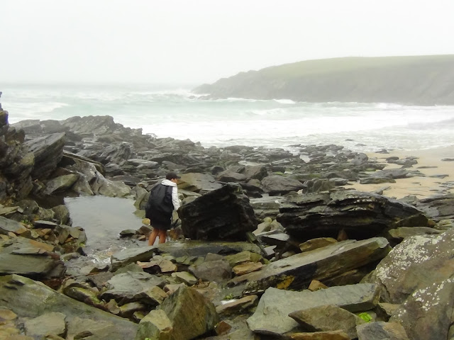
We soon find ourselves on the beach with its crashing waves
and wind driven sands. MK's legs are exposed and she feels the brunt of the
stinging sands. Natural exfoliation. Despite this, the raw remoteness of the
beach has its own unique beauty.
Off of the beach, we are back on the tarmac of the one lane
rural road. Damned berries! We can't help ourselves and frequently stop
to savor their juiciness.
We turn off of the trail to find a grocery store we were told
about. We buy picnic supplies for tomorrow's lunch since there will be no other
opportunities to do so for the remainder of our trek.
The mist turns to a heavy, wind driven rain just as we arrive
at our night's lodging. Sometimes luck is on our side.
Feohanagh to Cloghane
As I sit down for breakfast, I am still full from last
night's gourmet meal that our B&B hosts expertly prepared. And for
breakfast, it is more top notch food; grilled salmon, mushrooms and potatoes
for me, a cheese and mushroom omelet for MK.
Fortified, we set off on our 12 to14 mile day which is to
take us up and over a pass next to Mount Brandon. The mountain itself is
shrouded in clouds while the adjacent pass we are to climb over is clear,
located just below the ceiling formed by the dark grey cloud mass hiding Mount
Brandon.
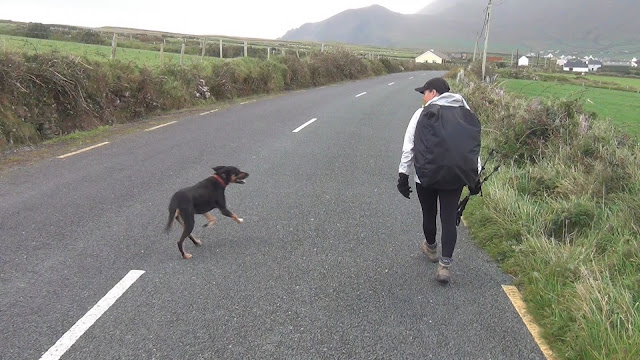
The village dog comes out from his barn to greet us as we
make our way down the narrow road. She will walk with us for the next several
miles as we make our way to the base of the mountain. I don't know if her
presence and insistence in walking with us is a good omen or a portend of tough
times ahead.
At the base, the road ends and the trail begins. There are no
switchbacks, just a straight as an arrow climb up to the pass, 2,000 feet above
us and 2-1/2 miles away. The path is wet and boggy making our boots waterlogged
too soon into the day's walk.
Behind us, the valley and the distant shoreline cliffs are in
full sunlight. Ahead and above us, the mountain and the pass are dark and
gloomy from the low level clouds.
We press on and are soon at the pass. The winds are strong,
perhaps 50-60 miles per hours. I stand into the wind at a 45-degree angle and
still, I do not fall forward. We take photos so that we can memorialize our
accomplishment.
As we descend, the wind continues its gale force strength
when it begins to sleet and hail. The downhill is treacherous enough, but made
more so due to the falling rain and ice.
The muddy trail is mired in bog, surrounded by wet grasses and puddles. To keep our feet somewhat dry, we hop from rock to rock, tussock to tussock - goat-like, as we continue our descent. The skies open up again and soak us with its icy rain. We've had all four seasons of weather in just the past 1-2 hours: sun, clouds, fog then clearing, wind, cold, warmth, dry skies and then rainy, icy skies.
The muddy trail is mired in bog, surrounded by wet grasses and puddles. To keep our feet somewhat dry, we hop from rock to rock, tussock to tussock - goat-like, as we continue our descent. The skies open up again and soak us with its icy rain. We've had all four seasons of weather in just the past 1-2 hours: sun, clouds, fog then clearing, wind, cold, warmth, dry skies and then rainy, icy skies.
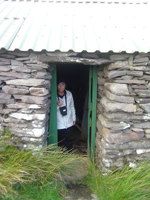
Near the bottom of the pass, a shepherd's shack mercifully
appears in the mist. We take shelter there and have lunch made from supplies
bought yesterday back on the trail. It energizes us as we continue the last
remaining windy and rainy miles of our trek.
Foot sore, we wearily walk into the small village of
Cloghane. After checking into our hostel for the night, we have a dinner at a
nearby pub where we chat with some of the other trekkers we have met on the
trail over the past several days. I drink one too many Guinness with a German
couple while we exchange travel stories and advice.
After a full meal and a hot shower (and many beers for me),
we sleep deeply, reveling in the accomplishment of the past three days of hard
miles we have walked.


O.K.... Now my legs are killing me. Enough with the narration!!! lol
ReplyDelete